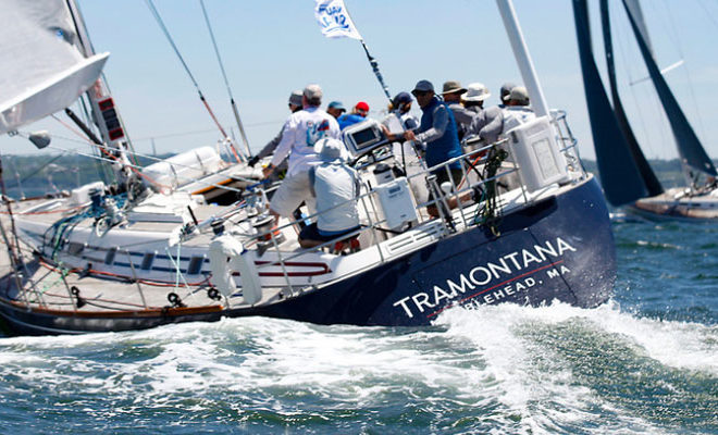
Boating, Fishing, and Travel Information for Salem, MA
Salem, on Boston’s “North Shore,” is an excellent harbor for use as a day-trip from Boston or as a stopover on a cruise to Maine and points further Downeast. With one of the richest histories of any New England community, Salem offers plenty to satisfy the boater who chooses to stop by for a night or even for an entire season.
Salem lies on Massachusetts Bay between Salem Harbor, which divides the city from much of neighboring Marblehead to the southeast, and Beverly Harbor, which divides the city from Beverly along with the Danvers River, which feeds into the harbor. Between the two harbors lies Salem Neck and Winter Island, which are divided from each other by Cat Cove, Smith Pool (located between the two land causeways to Winter Island), and Juniper Cove. The city is further divided by Collins Cove and the inlet to the North River. The Forest River flows through the south end of town, along with Strong Water Brook, which feeds Spring Pond at the town’s southwest corner. The town has several parks, as well as conservation land along the Forest River and Camp Lion, which lies east of Spring Pond.
Salem is home to the famous House of Seven Gables, Pioneer Village, the Salem Maritime National Historic Site, the Salem Willows Park, and the Peabody Essex Museum. It also features historic residential neighborhoods in the Federal Street District and the Charter Street Historic District. Much of the city’s cultural identity reflects its role as the location of the infamous Salem witch trials of 1692, as featured in Arthur Miller’s The Crucible.
See our weather radar, buoy data, marine forecast, and current weather for Salem, MA.
Helpful Resources for Salem, MA
- Mass.gov Saltwater Fishing Public Access – includes interactive public boat launch map
- Salem, Massachusetts – Tourism Website
- Marinas near Salem, MA
Local Goods & Services See All Nearby
Boating in Salem, MA Map View
Navigation:
Salem Harbor is about 1.5 miles long in a southwesterly direction. Dominion Energy’s power plant dominates the harbor. The city of Salem is on the western side of the harbor. The principal industries are tourism and electrical production. The city has many points of historical interest, including museums devoted to maritime subjects. Waterborne commerce is principally in petroleum, coal, seafood products and tourism. Salem Harbor is approached from the northward through a dredged section of Salem Channel.
On the western side of the dredged approach is Salem Neck. Salem Willows Park, the Salem Willows Yacht Club and a 400-foot public pier are on the northeastern extremity of Salem Neck. Excursion and party fishing boats operate from the three landings in the summer. Rowboats can also be hired. Depths of 4 feet are reported alongside the yacht club floats; gasoline and water are available. Reported depths of 10 feet are at the head of the public pier and 3 to 5 feet at the floats on each side of it.
Juniper Point, the eastern extremity of the neck, has many summer homes.
Juniper Cove, a shallow foul cove which is mostly dry at low water, lies between Salem Neck and Winter Island. A boat and yacht yard at the head of the cove can handle hull and engine repairs. In summer, small craft moor in the entrance to the cove between Abbot Rock, marked by a daybeacon, and Juniper Point. The cove is open to easterly weather, but the holding ground in the entrance is reported to be good.
A private light is shown from a white conical tower on the southeastern point of Winter Island. A ramp, pier and seasonal floats are located on the southern half of the island at Winter Island Maritime Park.
Great Aquavitae, a shoal area on the east side of the dredged section of Salem Channel, is marked by a daybeacon.
Conspicuous on Salem Neck are the oil tanks of the Salem Terminal and the three stacks of the power plant adjacent to the north. The stacks are lighted.
A marina is about 300 yards southwestward of Salem Terminal Wharf. Depths of 5 to 10 feet are reported alongside the floats; water, electricity, ice, storage facilities and hull and engine repairs are available.
A lighted buoy marks the entrance to two dredged channels leading along the east and west sides of Derby Wharf, respectively. The northerly channel leads to an anchorage basin on the east side of the wharf. In 1993, the channel had a controlling depth of 7 feet with 1 to 8 feet available in the basin except for shoaling to bare along the northern and northeastern sides. A public float is midway along the wharf; moorings are available in the basin. The southerly channel, on the west side of the wharf, leads to South River.
South River, a short estuary extending into the city of Salem, has its entrance through a dredged channel leading along the west side of Derby Wharf. In 2006–2007, the controlling depth was 10 feet in the channel to the westward turn into South River, thence 4.8 feet (5.5 feet at midchannel) from the turn continuing west to a point about 100 yards below the fixed bridge over South River.
On the west side of South River, large industrial buildings and warehouses are conspicuous. The fixed bridge across South River has a 43-foot span with a vertical clearance of 7 feet. A pumpout facility is at the Congress Street Landing. Gasoline, water and most services are available at the floats of the marina on the north bank. It has been reported that navigation through the Congress Street Bridge is hazardous during periods of maximum flood and ebb.
A channel south of Long Point and marked by private buoys leads westward from the South River entrance channel to a yacht club in Palmer Cove.
The southwestern part of Salem Harbor is shoal and at the head particularly foul, southward of Pickering Point.
South of Palmer Point, a large yacht yard with marina has a marine railway, the largest in the area, that can haul out craft up to 100 feet in length. A privately dredged 8-foot channel, marked by piles, leads to an anchorage basin off the yard. Water, open and covered winter storage, overnight berthage with electricity and most services are available at the yard. The yard maintains guest moorings.
Wharves:
Dominion Energy, Salem Harbor, L.C.C. Power Plant Wharf (42°31’27″N., 70°52’40″W.): 700-foot face; 900 feet of berthing space with dolphins; 35 feet alongside; deck height, 14 feet; pipelines extend to storage tanks with 650,000-barrel capacity; receipt and shipment of fuel oil and coal; owned and operated by Dominion Energy, L.C.C.
Derby Wharf, on the west side of Salem Harbor about 0.4 mile southwestward of Salem Terminal Wharf, is a stone jetty about 0.3 mile long, marked at its outer end by a private light. The wharf and the old customhouse on its shore end are now part of the Salem Maritime National Historic Site under the U.S. Department of the Interior.
Anchorages:
A special anchorage is in the south and east parts of Salem Harbor and extends eastward along the south side of South Channel to Peachs Point. The harbor is sometimes used as a harbor of refuge, especially during the autumn. Good anchorage is available in what is known as the outer anchorage southward of the main channel and northward and eastward of Little Haste.
Ice:
The head of Salem Harbor on the flats usually is closed by ice every winter during January and February, but the formations rarely extend beyond the coal pier except in unusually severe winters. Northerly and northwesterly winds are most favorable to local formation in Salem Harbor.
Winds from southward and westward, during light formation, have a tendency to carry the ice off to sea, while those from eastward usually break up the formation both in the harbor and its approaches
Channels:
Three main channels leading through the islands and rocks at the entrance are known as Salem Channel, Childrens Island Channel and Marblehead Channel. Several other channels of less importance are used only by local boats. Most of the dangers adjacent to, or on the channel edges, are marked.
Salem Channel, the deep-draft and most northerly channel, leads westward between Bakers and Great Misery Islands and through Salem Sound for about 3 miles, thence southwestward through a dredged section to a turning basin on the northwest side of Salem Harbor. The entrance is marked by Hospital Point Lighted Range on bearing 276.3°. Several buoyed dangers, described later under dangers, are close to the sailing line. Salem Channel is well marked.
Childrens Island Channel, the middle one, has its entrance near Halfway Rock. It leads in a northwesterly direction between Childrens Island on the west and Satan Rock, Brimbles and Eagle Island on the east. The least depth in Childrens Island Channel, about 26 feet, is between Eagle Island and Childrens Island.
Eagle Island Channel, deep, clear, sheltered and buoyed, leads from Salem Channel in a southwesterly direction between Hardy Rocks and Eagle Island on the northwest and Bakers Island, Pope Head Shoal and Brimbles on the southeast. It is used by most craft bound to Marblehead Harbor from the northeastward.
Marblehead Channel, the southwesterly one, leads in a northwesterly direction between Childrens Island and Marblehead Rock, thence northeasterly between Chappel Ledge and Childrens Island, thence northerly between Coney Ledge and Eagle Bar to Salem Sound. Dangers of less than 18 feet in Marblehead Channel are marked except for a 17-foot spot in about 42°29’40″N., 70°49’10″W. Fifteen-foot Rock, about midway between Marblehead Rock and Cormorant Rock, is marked by a lighted bell buoy.
South Channel leads westerly along the northern shore of the peninsula between Marblehead and Salem Harbors. The channel, fringed by rocks and ledges, is less than 100 yards wide in its narrowest part and is not recommended for strangers drawing more than 10 feet.
Dangers:
The approaches to Salem, Beverly and Marblehead Harbors have very broken ground, and all of the channels lead between islands and rocks, bare and submerged. Caution is necessary at all times. Strangers should not attempt to enter or leave in thick weather.
An extensive area of rocky patches and reefs, marked by buoys on its northeasterly, easterly and southerly sides, extends about 2 miles southeastward of Bakers Island, ending with Newcomb Ledge, which is covered 20 feet. A lighted whistle buoy is about 0.7 mile east-southeastward of the ledge. In this area are Searle Rock, Middle Breakers, Southeast Breakers, Inner Breakers and Davis Ledge, all unmarked. Middle and Inner Breakers are partly bare at low water, and all break in heavy weather.
Hardy Shoal; of which Hardy Rocks uncovers 7 feet, and Rising States Ledge, covered 3 feet, are a part; extends from 0.6 to 0.8 mile westward of Bakers Island Light. The shoal is marked on its eastern side by a daybeacon.
Bowditch Ledge, 1.2 miles west-northwestward of Bakers Island Light and 300 yards southward of Salem Channel, is marked by a daybeacon 30 feet high with red and white diamond-shaped daymark on a conical granite monument; the daybeacon is very conspicuous when approaching the harbor. The extension of the ledge northeastward is marked by a lighted buoy. House Ledge, covered 10 feet, and two ledges, covered 14 and 16 feet, all unmarked, are 0.4 mile eastward, 0.1 mile eastward, and 0.2 mile southeastward of Bowditch Ledge, respectively. Powers Rock, covered 14 feet and marked by a lighted bell buoy, is on the northern end of Bakers Island Shoals. These dangers are all south of the Salem Channel range line.
North of Salem Channel, a ledge covered 12 feet and marked by a buoy extends southwestward from Little Misery Island. Misery Ledge, covered 18 feet and unmarked, is about 0.5 mile westward of Little Misery Island. John Ledge, covered 13 feet and about 0.1 mile westward of Misery Ledge, is marked close to the southward by a lighted buoy.
Great Haste is a bare rock surrounded by ledges on the south side of Salem Channel, 2.4 miles westward of Bakers Island. Little Haste, close northwestward of Great Haste, is awash at low water and marked by a daybeacon. A 17–foot spot on the northwest end of Haste Shoal, about 650 yards north-northwest of the daybeacon, is marked on the north side by a lighted buoy.
Pope Head (42°31.7’N., 70°47.8’W.), 300 yards northwestward of North Gooseberry, is a rugged, bare rock surrounded by ledges to a distance of 150 yards. A buoy marks Pope Head Shoal, the western extremity of the ledges around the islet.
Satan Rock, 0.5 mile east-southeastward of Childrens Island, is a small bare rock marked by a daybeacon. The rock should be given a berth of over 200 yards.
Brimbles is a rock awash at low water 0.3 mile south-southeastward of Eagle Island. It is marked by a red and white diamond-shaped daymark on an iron spindle. The daybeacon should be given a berth of over 200 yards.
Eagle Bar, an extensive foul ledge and shoal area extending from Eagle Island to the northward, eastward and westward and terminating with Cutthroat Shoal, covered 6 feet, on the northeast and Midchannel Rock covered 5 feet, on the southwest, is marked on its eastern, southern, and western extremities by buoys.
Grays Rock, 0.7 mile northwestward of Childrens Island, is 10 feet high. Chappel Ledge, covered 14 feet, about 350 yards eastward of Grays Rock, is marked to the eastward by a lighted buoy. Coney Ledge, an extensive ledge extending southeastward from Coney Island, is marked at its easterly end by a buoy.
Islands and rocks, sunken and bare, extend 2 miles southward and southwestward from the south end of Marblehead Neck. Some of these dangers are marked by buoys, and the channels between them are used by local boats, but the area should be avoided by strangers. A lighted bell buoy marks Outer Breakers, covered 8 feet, the southeastern end of the broken ground.
Dangers showing above water are Great Pig Rocks, bare at high water; Southwest Breakers, awash at low water; Sammy Rock, awash at low water and marked by a buoy; Ram Islet, high, rocky and grassy; Little Pig Rocks, awash at high water; Roaring Bull, bare at low water and marked by a daybeacon; and Tinkers Island, marked by several houses.
A bar with little depth connects Tinkers Island with Flying Point, the southern end of Marblehead Neck.
Tom Moore Rock, at the eastern end of a reef extending 500 yards eastward from the middle of Marblehead Neck, uncovers 6 feet and is marked by a buoy.
No attempt has been made to describe all of the dangers, shoals, rocks and ledges, as all those known are charted. Most of those in or near the fairways, or near the channel edges, are marked. Charts 13275, 13276, and 13274 should be the guide and due caution exercised. Important dangers within the limits of the three harbors will be described where necessary under the description of each individual harbor and its facilities.
A buried high-pressure natural gas pipeline extends along the sea floor from south of Woodbury Point in Beverly eastward along the bottom into Salem Sound and then southeast into Broad Sound. Mariners are advised to use extreme caution when anchoring in these areas.
Sponsored Content
High Tide Flooding Outlook for April 2024
By US Harbors. Coastal Flooding Predictions for April 2024 April's highest tides will happen at the end of the 2nd week of the month, starting as early as April 7 in some places, and heading back to normal after the 11th or 12th. There are some location-specific outliers we're highlighting… Learn More
Fishing in Salem, MA Map View
Coastal News Updates See All
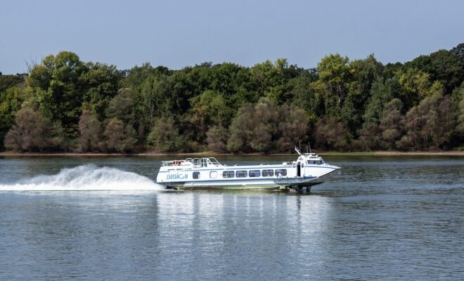
Using Hydrofoils to Improve Boat Performance
4/16/2024
By Capt. Vincent Daniello. In my early days as a captain, few boats cruised faster than 30 mph. Back then, bigger engines and the fuel they burned added too much weight, netting little more speed. Today, even modest performers top 50 mph thanks to lighter engines and boat construction, where more… SEE MORE
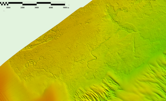
Possible Ancient River System Discovered off Wilmington, North Carolina
4/15/2024
By noaacoastsurvey. During the 2023 field season, NOAA Ship Ferdinand R. Hassler was tasked with surveying an area offshore of Wilmington, North Carolina, in the vicinity of Frying Pan Shoals—a dynamic area of dangerously shallow waters. While scientists and crew conducted mapping surveys of the seafloor, they discovered what is believed to… SEE MORE
Going Electric
4/14/2024
By John Wooldridge. When Dave and Danielle Baker and their two young children pull up to a marina and begin maneuvering into a slip, they often get wondering stares from people on the dock. Instead of emitting diesel exhaust and noise, their Island Packet 27 sloop Gilbert Ivy purrs quietly and handles… SEE MORE