Boating, Fishing, and Travel Information for Rockport, MA
SEE MORELocal Goods & Services See All Nearby

Sponsored Content
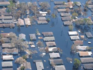
High Tide Flooding Outlook for April 2024
By US Harbors. Coastal Flooding Predictions for April 2024 April's highest tides will happen at the end of the 2nd week of the month, starting as early as April 7 in some places, and heading back to normal after the 11th or 12th. There are some location-specific outliers we're highlighting… Learn More
Fishing in Rockport, MA Map View
Coastal News Updates See All
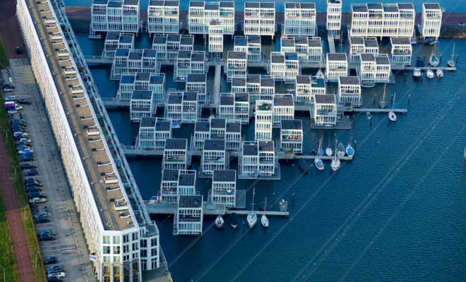
A Dutch Architect’s Vision of Cities That Float on Water
By Kyle Chayka. In a corner of the Rijksmuseum hangs a seventeenth-century cityscape by the Dutch Golden Age painter Gerrit Berckheyde, “View of the Golden Bend in the Herengracht,” which depicts the construction of Baroque mansions along one of Amsterdam’s main canals. Handsome double-wide brick buildings line the Herengracht’s banks,… SEE MORE
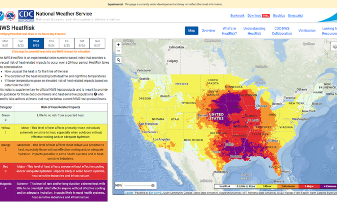
NOAA Announces National Heat Forecast Tool: HeatRisk
By NOAA. NOAA is expanding the availability of a new experimental heat tool called HeatRisk ahead of the hot summer months. A collaboration with NOAA’s National Weather Service (NWS) and the Centers for Disease Control and Prevention (CDC), HeatRisk provides information and guidance for those who are particularly vulnerable to… SEE MORE

The Hunt for an Elusive Florida Shipwreck That Killed 41 Enslaved People
By KARUNA EBERL. Searching for the slave ship Guerrero, the nonprofit Diving With a Purpose has also trained scores of young Black men and women to find and tell stories once lost to the waves. CARYSFORT REEF WAS DARK UNDER the new moon. Coral tentacles undulated with the changing tide, while… SEE MORE